Two Moors Way classic self-guided walk in eight walking days with luggage transfer
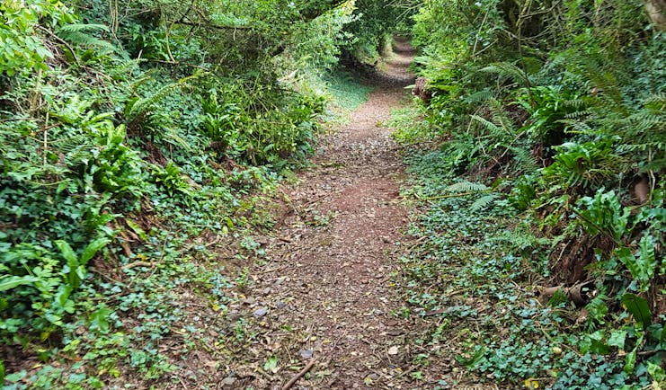
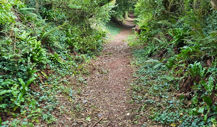
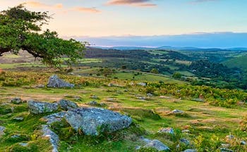
This is a classic Two Moors Way self-guided walk with luggage transfer and stays in small hotels, pubs and B&Bs but slightly shortened with two longer days in the middle section of the walk. This classic combines the dramatic National Parks of Dartmoor and Exmoor and a variety of rolling Devon and Somerset scenery in between: fields of grazing sheep and cattle, rich red soils of farming land, densely wooded valleys, running streams and rivers tumbling over boulders, archaeological sites from the bronze and iron age including remains of settlements and menhirs, mediaeval stone bridges, crosses and churches. The days are varied, with the walking being on a variety of terrains, including earthy leafy paths, wide springy moorland tracks, grassy fields, stone paths, some wooden walkways, and some tarmac stretches of road. The variety also applies to the gradient: some stretches are steep down and up again and others allow for a steady march along a ridge line, where you can pick up speed and relax in the breeze whilst soaking up the vistas. This walk offers some of the most superb landscapes of the south-west of England and there is time to visit and explore some of the well-known places, both historic and folkloric, along the route, such as Widecombe, Grimspound, Hurston Ridge standing stones, Chagford, Castle Drogo and Tarr Steps. The colours change with the seasons: in spring you’ll see carpets of bluebells and in late summer and autumn swathes of purple heather and yellow gorse. There are areas of scientific interest and you’ll see ponies on Dartmoor and Exmoor, and red deer have survived on Exmoor since pre-historic times. Salmon and trout spawn in the rivers and nearby birdlife will include dippers and gooseanders. We offer you a choice of accommodation that includes B&Bs, pubs, hotels and country house hotels.
Highlights
River Dart • Dartmoor • Widecombe in the Moor • Grimspound bronze age settlement • 49 standing stones • Chagford • Castle Drogo • Tarr Steps • River Barle • Exmoor • Exe Head • Combe Park Wood • Myrtleberry Cleave • Lynmouth
Holiday price guide Sample prices are per person based on two people sharing a double or twin room for nine nights.
From about
£890 Classic accommodation
Holiday Code CW002
Additional nights can be added before, after or during the tour.
Call us on 01392 441266
Two Moors Way classic self-guided walk in eight walking days with luggage transfer
You reach your first overnight stop today with your own travel arrangements, perhaps by train to Ivybridge and then taking a taxi. Remember to pre-book a table if you want to dine in. Allow time to check your kit, pack your rucksack and study your guides and maps.
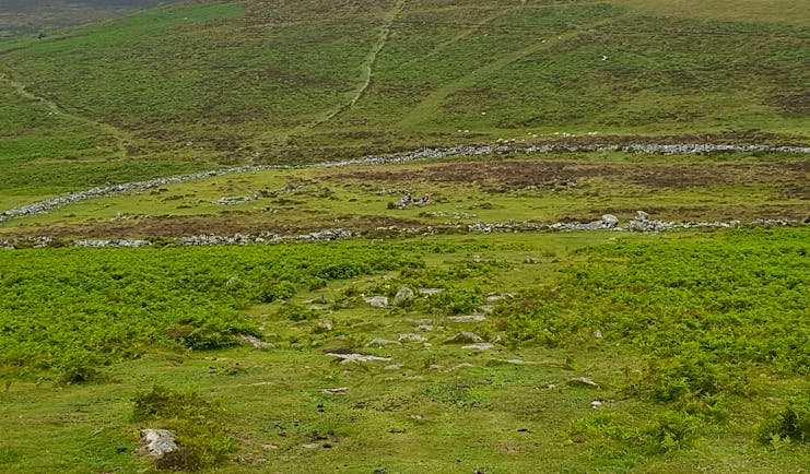
This is the first stage of the Two Moors Way and you are thrust quickly into the wide and barren expanse that is much of Dartmoor. The route starts off by following a disused tramway and this starts to introduce the visitor to the complex uses and workings of the moor over many thousands of years. This area on Harford Moor is rich in evidence of prehistoric settlements with is stone rows, cairns, tin workings and blowing houses (a building used for smelting tin), pounds and clapper bridges, the latter being a prominent feature of Dartmoor. To your left there is the Erme Valley containing Piles Copse, one of three areas of upland oak woodland, where stunted oaks rise out of a bed of granite boulders. At times today there is little signage and the route traverses open moorland. You cross the river Avon by a clapper bridge. Near here, at Huntingdon Warren, you can see the signs of local rabbit farming which took place on the moor from the 13th century until the 1950s. Warrens were set up often to provide the workers of the tin mines with food and skins. At a point near Pupers Rock you will be able to view the tower of Buckfast Abbey to your right. Shortly before Scorriton you meet a lane that leads down to the village.
Distance: About 13.5 miles
Time: About 7 hrs
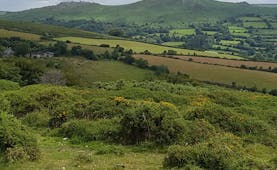
Today you meet with some glorious Dartmoor landscape and panoramic views, although there are some relatively steep up and downs, ending with a picturesque climb from the West Webburn river to the southern edge of Hamel Down, above Widecombe. After a start through fields you drop after Holne to a wooded track along the banks of the River Dart to New Bridge, a narrow stone bridge dating from the 15th Century. You pass under the bridge and follow the river towards Deeper Marsh, a popular spot for bathers in good weather. Soon there is a steep climb through woods and bracken passing the rocky outcrops of Leigh Tor. Then you will soon join Dr Blackall’s Drive which affords panoramic views across the steeply wooded and steeply sloped valley of the River Dart to Bench Tor and Combestone Tor. From here you descend across Sherberton Common and a single-track road to Ponsworthy. Rest for a moment or two alongside the ford and then follow the West Webburn river along a wooded track to reach the hamlet of Jordan. Then it’s uphill passing farms and just off from the route is the abandoned, mediaeval settlement of Hutholes. Shortly afterwards you reach the edge of Dunstone Down, at the southern end of Hamel Down. There is a carpark here at the end of today’s walk where we can arrange for a car to meet you or you can walk down Southcombe Hill into the village of Widecombe, to explore the Church of St Pancras, the old pig house, the National Trust’s The Church House, the village green and perhaps enjoy a cup of tea in the tea room.
Distance: About 12 miles
Time: About 7 hrs
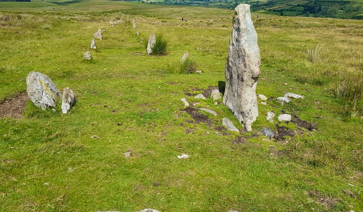
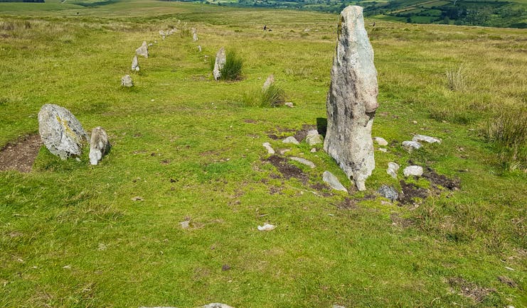
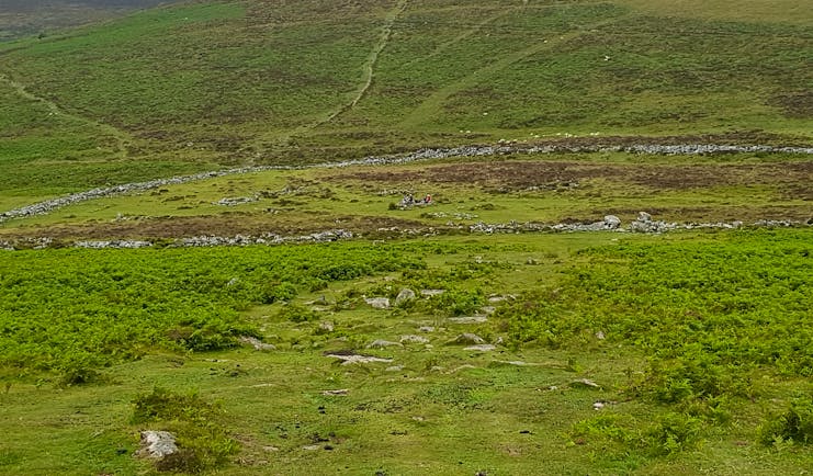
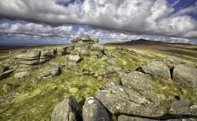
This is another fine Dartmoor day combining open expanses of moorland with tremendous views, a bronze age settlement and prehistoric standing stones, perhaps a detour to the highest pub on Dartmoor, and then more open commonland, followed by shady and sometimes damp woodland tracks, fields and green lanes before reaching the banks of the River Teign near Chagford. You start today’s walk back at Dunstone Down and follow the wide track as it bears uphill towards Hamel Down affording views across Widecombe to Bonehill Rocks and to the Warren House Inn in the other direction. At Broad Barrow the track veers downhill quite steeply to the bronze age settlement of Grimspound sheltering in a hollow beneath Hookney Tor to which the track ascends. You reach Bennett’s Cross and here, if you have time and inclination, you can divert to the Warren House Inn, along the B3212. Otherwise you continue along a narrow moorland track until you spot the 49 Standing Stones. The track broadens out and allows a very pleasant stroll across common land, with opportunities to rest on boulders before you reach the single-track road that leads to Fernworthy. From here it’s a mixture of road, farm track, field, wooded path, often damp under foot or on boards passing secluded farms, houses and hamlets before you descend and ascend and descend along narrow, green lanes to reach Leigh Bridge over the River Teign. A road along the river leads you to Chagford Bridge and it’s then about half a mile on a single-track road up into the centre of Chagford.
Distance: About 11 miles
Time: About 6 hours
The walk today starts off gently as you can amble along the meadows and wooded paths of the River Teign before you ascend through the grounds of Castle Drogo, traverse around the hillside on a narrowish but flat path high above the Teign Valley, before entering the pastures of the farmland on the edge of the moor and then it’s up and down along lanes and through woodland before reaching your stop for the night. Highlights of today are surely the initial stretch of the route as you follow the banks of the Teign with views behind you to Chagford and Meldon Hill and then the awe-inspiring views from the track by Sharp Tor beneath Castle Drogo. Drewsteignton affords the chance of a cup of tea or a drink and time to absorb the picturesque architecture of the village before you continue northwards, ascending and descending a patchwork of fields and woodland. Pause to visit the ancient church of Hittisleigh Barton before continuing along a mixture of narrow roads and farm tracks. There is a particularly green lane that ascends after you cross the River Troney and then there is a charming woodland descent after Granny’s Meadow Nursery through Horwell Wood before you cross what was the Exeter to Okehampton railway line, a section from Coleford Junction that was opened in 1871.
Distance: About 15 miles
Time: About 8 hours
Today and tomorrow are transition days from Dartmoor to Exmoor walking through the Devon heartland of rolling hills and wooded valleys. The first part of the walk today takes you past the Paschoe Dairy Farm and Appledore Farm onto open fields until a flat track leads you to the settlement of Clannaborough Barton. This is a cluster of farm buildings and a few houses with a 16th century church (St Petrock). You cross the busy A3072 and then climb up a narrow lane with banks of red soil. Still more tracks and fields until you reach the very busy A377 which you cross as the track takes you away from the road, following parallel to the railway line, known as the Tarka Line from Crediton to Barnstaple. The llamas in the field here usually stop to stare at you. Just ahead is Morchard Road with its railway station and Devonshire Dumpling pub just off the track with bears right over the railway line and continues through rich pastureland and fields in the direction of Morchard Bishop. This is the halfway point of the original Two Moors Way and is deep Devon farming countryside. At Slade you pass the end of a line of wildlife ponds and then through an orchard. The area abounds with cob and thatched barns and houses. Once you reach Morchard Bishop look back for views of Dartmoor in the distance. The village possesses a long row of thatched cottages from the 18th century and has a 15th century church dedicated to St Mary with a tower that is almost one hundred feet tall. Take your time to enjoy the Devon heartland with much of the track now through fields and pastureland, with the odd wood and coppice, stream and footbridge to cross. There is the ancient hamlet of Washford Pyne, recorded in the Domesday Book. Still more farms and fields and cottages until you emerge from the gardens of the village houses to find yourself in the Square of Witheridge with its coaching inn, the Mitre, dating from the 1830s.
Distance: About 14 miles
Time: About 7 hours
This is also a relatively quiet day but a long one in terms of distance, as the lush countryside of the Devon heartland continues to be crossed by the track. Woodland, water meadow, fields of wildflowers and wildlife such as fallow deer and buzzards can be found today. As you cross the Little Dart you’ll see Bradford Mill which was a working mill from the 17th until the 20th century. There is also moorland at Creacombe where you climb to over 800ft (almost 250m) above sea level and enjoy views over the rolling farmland towards the southern edge of Exmoor. Soon you’ll experience another Devon green lane and then open land surrounded by a network of small fields at Knowstone Moor. There is the Outer Moor and the Inner Moor and along with nearby Hares Down, these patches of land are now rare culm grassland, a mixture of purple moor-grass and wet heath, which absorbs water at five times the rate of ordinary grassland. Locals still have common grazing rights to the land. Knowstone is a pretty cluster of houses and a designated conservation area with a 15th century church and unspoiled churchyard. On Owlaborough Moor are tumuli, vestiges of the occupation of this land over the centuries and a little further on is the dismantled track of the Devon and Somerset Railway and the tiny village of Yeo Mill, where there are signs in its former coaching inn and village shop that these places would have been busier in times gone by. Enjoy the streams, hedges, green lanes and wooded patches before reaching the village of West Anstey with its 14th century church dedicated to St Petrock. You skirt common land and soon enter the start of the Exmoor section of the Two Moors Way. Note the sign which tells you that there are only 24 miles to go to Lynmouth. You have views to the village of Hawkridge sitting above the valley of Dane’s Brook to the south and the attractive valley of the River Barle to the north. At Hawkridge you meet the Exe Valley Way. The Two Moors then follows the side of the ridge, forested below you as it drops down to the river, before you descend to the iconic Tarr Steps. Tarr Steps is a 17-span clapper bridge located at an ancient fording point of the River Barle and one of the longest of its kind in Britain. The woodlands around the Tarr Steps and along the banks of the River Barle are a National Nature Reserve and are significant for the mosses, liverworts and lichens that are found here. There is also a moss found in burrows which appears to glow in the dark. There are mature hazel, blackberry and honeysuckle and otters feed on the fish and eels found in the river. Dippers and kingfishers are likely to be seen on the river. Just above Tarr Steps is Winsford Hill and its extension, South Hill, home to the Anchor herd of Exmoor ponies, free living and thought to be a race of wild horse rather than a breed.
Distance: About 18 miles
Time: About 9 hours
Today is a shorter walk than yesterday, allowing time to linger at beauty spots along the route. From Tarr Steps you head along the riverside path which does become uneven over rocks along the edge of the river for a relatively short stretch, although this can be wet. There are also spots which will be muddy in between tree roots. Having said that, it is a magical stretch of the walk, as the sunlight plays through the branches and leaves of the trees and you listen to the water of the river as it tumbles over rocks. After a while there is a charming stretch through riverside meadows before an ascent into woods above Withypool. Look out for the Royal Oak Inn or a tea-room near the bridge where you can find food and drink. There is also a village store selling sandwiches and drinks too. From Withypool you ascend from the village through fields and then follow a quiet lane gently uphill until it reaches moorland. The track crosses the moorland above the wide valley affording wonderful views and from here you can see the historic Landacre Bridge. Exmoor ponies may be seen in this area too. The track across the moor is wide and easy before you drop down slightly to follow the river more closely. Ahead is Cow Castle, an iron age fort, and beautiful wildflower meadows along the riverbank. In high summer there are splashes of orange crocosmia along the route here. It can be boggy and wet underfoot before you reach the higher ground as the path tracks around Cow Castle. There is more beautiful riverbank before you reach the remains of Wheal Eliza, once a copper mine. From here to Simonsbath the path has been restored for all levels and it’s quite wide and relatively flat as you follow it slightly above the river at this point. Simonsbath has places to eat and drink.
Distance: About 11 miles
Time: About 5.5 hours
This is the final stage of the Two Moors Way and it’s a fitting end to the route with what can be a demanding day with the ground underfoot being rough and boggy as you climb out of Simonsbath and the valley through the Ashcombe Plantation onto moorland towards the source of the River Exe and the watershed. You cross the Chains, Exmoor’s highest and remotest area, which rise to 1599 ft (487m) and usually displaying white cotton grass in high summer. You follow the side of the valley of Hoaroak Water to reach the Hoar Oak tree which marks the boundary of the Royal Forest and which stands on the Devon-Somerset border. Here you re-entre Devon and then proceed over more high ground at Cheriton Ridge. Views to the east are towards Brendon Common and beyond that Doone Country, which inspired R D Blackmore’s novel Lorna Doone. You enter the woodland of the National Trust’s Coombe Park which incorporates one of the largest areas of semi-natural woodland in the southwest. There are tremendous views over the wooded, steep valley of the East Lyn river and patches of sea to be spied ahead. Following Coombe Park wood is the National Trust’s Watersmeet House, at the confluence of the Hoaroak and East Lyn rivers. You pass the iron age enclosure of Myrtleberry South and then enjoy the spectacular views as the East Lyn runs through Myrtleberry Cleave. There is still some uphill climbing with a zigzag just before, finally, there is a long descent into Lynmouth.
Distance: About 12 miles
Time: About 6 hours
Holiday price guide Sample prices are per person based on two people sharing a double or twin room for nine nights.
From about
£890 Classic accommodation
Holiday Code CW002
Additional nights can be added before, after or during the tour.
Our prices include
● Accommodation in a double or twin room on bed and breakfast
● Packed lunch every day except day of arrival
● Luggage transfer between hotels
● Guidebook and our walking notes
Additional information
Our prices do not include taxis on arrival, departure or during the walk, or early check-in or late check-out at any of the accommodation.
Call us on 01392 441266
Holiday price guide Sample prices are per person based on two people sharing a double or twin room for nine nights.
From about
£890 Classic accommodation
Holiday Code CW002
Additional nights can be added before, after or during the tour.
Our prices include
• Accommodation in a double or twin room on bed and breakfast
• Packed lunch every day except day of arrival
• Luggage transfer between hotels
• Guidebook and our walking notes
The journey and how you get there
There is a railway station at Ivybridge and the nearest ones to Lynmouth are at Barnstaple, Tiverton Parkway and Taunton. Barnstaple can be reached by bus from Lynmouth and then there are regular trains to Exeter.
We do not include taxis but can provide contact details for taxi companies. Also, if you need a taxi during the walk (which may be required depending on where you stay), your hotel will be able to arrange it for you. Luggage transfer is included from hotel to hotel for you for up to two items of luggage.
Additional information
Our prices do not include taxis on arrival, departure or during the walk, or early check-in or late check-out at any of the accommodation.
Call us on 01392 441266
Two Moors Way classic self-guided walk in eight walking days with luggage transfer
This is a B&B with two en-suite bedrooms situated on the edge of the town of Ivybridge.
Superking or twin ensuite
This is a village pub with 4 rooms, all en-suite, enjoying views over Little Combe Valley. Extensive evening menus. Clotted cream from the dairy farm next door.
Double room
A 4-star hotel set in 11 acres of grounds at the base of Haytor, with two restaurants.
Classic double room
Traditional pub with four bedrooms in the centre of Chagford. Dates from 16th Century. Real ales and choice of food.
Standard double room
A characterful, thatched, freehouse pub with accommodation in the village of Coleford with good pub menu and local beer.
King double room
Village pub with five cosy rooms dating from the 17th Century with open fire and good food.
Double room ensuite
Top gastro pub with nine comfortable rooms and an excellent restaurant. Cosy and magical location.
Double room
This hotel is over 350 years old and stands on the river Barle. Combines tradition and comfort. All rooms have valley view. 2 and 3 course options for dinner.
Double room
A village inn in the valley of Brendon with rooms and traditional restaurant serving locally sourced seafood, poultry and game as well as Exmoor venison.
Double room
These are examples of the accommodation used - a mixture of B&Bs, pubs and inns, and country hotels. Because some of the accommodation have a limited number of rooms, alternatives may be offered at the time of booking. This may necessitate a slight change to the route and to your requirements for taxis. Classic accommodation: Cadleigh Manor B&B near Ivybridge, The Tradesman's Arms at Scorriton, The Moorland Hotel at Haytor, The Ring o Bells at Chagford, The New Inn, Coleford, the Mitre Inn at Witheridge, Tarr Farm Inn at Tarr Steps, Simonsbath Hotel at Simonsbath, the Staghunters Inn at Brendon near Lynmouth.
Holiday price guide Sample prices are per person based on two people sharing a double or twin room for nine nights.
From about
£890 Classic accommodation
Holiday Code CW002
Additional nights can be added before, after or during the tour.
Our prices include
• Accommodation in a double or twin room on bed and breakfast
• Packed lunch every day except day of arrival
• Luggage transfer between hotels
• Guidebook and our walking notes
The journey and how you get there
There is a railway station at Ivybridge and the nearest ones to Lynmouth are at Barnstaple, Tiverton Parkway and Taunton. Barnstaple can be reached by bus from Lynmouth and then there are regular trains to Exeter.
We do not include taxis but can provide contact details for taxi companies. Also, if you need a taxi during the walk (which may be required depending on where you stay), your hotel will be able to arrange it for you. Luggage transfer is included from hotel to hotel for you for up to two items of luggage.
Additional information
Our prices do not include taxis on arrival, departure or during the walk, or early check-in or late check-out at any of the accommodation.
Call us on 01392 441266
Two Moors Way classic self-guided walk in eight walking days with luggage transfer
About Great Britain
The countries of Great Britain, England, Scotland and Wales, provide a wealth of beautiful and interesting walking terrain. Within a relatively small area there is a richness of diversity of geography and topography, peoples and dialects, local architecture and traditions and a rich history that has been world-facing and world-interacting for thousands of years. The landscape of this small island varies every few miles, with dales and vales, moors and coastline never far away and here and there you find proud post-industrial cities, flourishing cathedral cities, gentle market towns and picturesque villages, perhaps with a village green, pond, cricket pitch and ancient church, as well as the local pub. Traditions of local heritage feature strongly with festivals and pageants, local arts and crafts and artisan produce. There are many National Parks and designated walking paths. There are recognised coast to coast walks such as the Two Moors Way from the English Channel to the Atlantic Ocean, or the Coast to Coast walk in northern England; there are walks that cover historic landmarks such as Hadrian’s Wall; there are walks that introduce the rambler to the awe-inspiring natural landscape of lakes and mountains such as the West Highland Way; there are walks that hug the dramatic coastline of Great Britain such as the South West Coastal Path or the Northumberland Coast Path. Ordnance Survey maps provide support from not just contours and terrain but historic and noteworthy points of interest too. Within many walks of just a few miles, the rambler will experience a delightful variety of terrain, aspect and vegetation.
Facts in brief
Capital LondonAirport London Heathrow, London Gatwick
Size 209,331 sq km
Population 64.55 million

